Edgartown Light
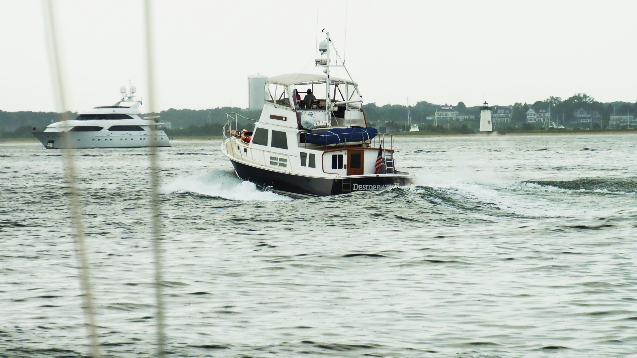
As we were approaching Edgartown Harbor and sailed past Cape Poge Light, another lighthouse kept getting more and more prominent — Edgartown Harbor Light, right at the entrance to Engartown Inner Harbor.
I was expecting to see it, so I was not surprised, but rather glad and relieved. The lighthouse is very easy to reach from the town; when I had been at Edgartown before, by bike with my dad, we made a point of exploring it. But now was the first time when I saw it from sea, the way it is supposed to be seen, and I was glad to see it — the way people are glad to see a familiar face in a crowd.
Edgartown is the oldest settlement on Martha’s Vineyard (1642). Originally called Great Harbor, it was incorporated in 1671 as Edgar Towne, after Edgar, Duke of Cambridge, whose father James was back then an heir presumptive to the English throne (which he got later as James II). In fact, Edgar had died a month before that, at the age of three, but news traveled slow back then. As I mentioned elsewhere, Edgartown was an important whaling port in 1800s, and as such a rich town. As the whaling declined, the town’s fortunes declined as well, and it took many decades for it to recover and to reinvent itself.
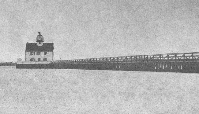
In 1828, the Congress allocated $5500 to build a lighthouse slightly offshore at the entrance to the harbor. The lighthouse keeper had to row a short distance to get to the lighthouse. Two years later, a 1500-foot-long walkway was built to connect the lighthouse to land.
The lighthouse was in a good shape through the early 1900s, but then it got seriously damaged in the Great Hurricane of 1938. The Coast Guard was going to demolish it and replace with a steel “skeletal tower”. That’s what they typically do; the Coast Guard is in the business of enabling a cost-effective navigation, not preserving history or aesthetics. We talked about that before, in the post on Deer Island Light.
Unlike Deer Island Light, however, things turned out better for Edgartown Light: there were more options in the 1930s. After protests of local residents, the Coast Guard brought over an unused lighthouse from the town Ipswich — a modest 45-foot-tall cast iron tower that used to be one of the two range lights on Crane’s Beach — and put it up as the new Edgartown light.
The tower still stands here. The Coast Guard ultimately found a way to get rid of it, and sold it to the town of Edgartown for $1. The light, flashing red every 6 seconds, still remains an active aid to navigation, though I must admit that I didn’t see it as we were anchored in the outer harbor overnight. It was foggy most of the night though, so probably I was not looking well enough.
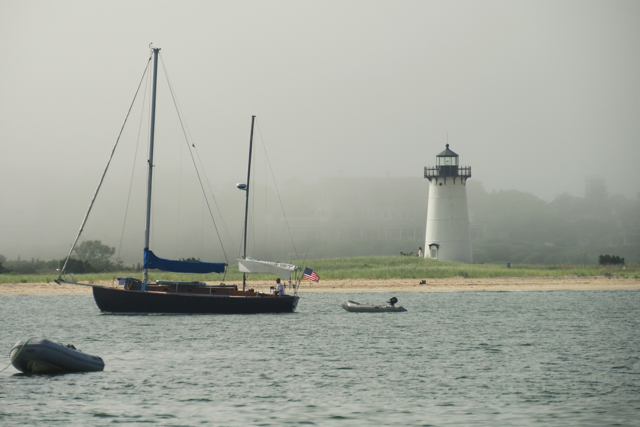
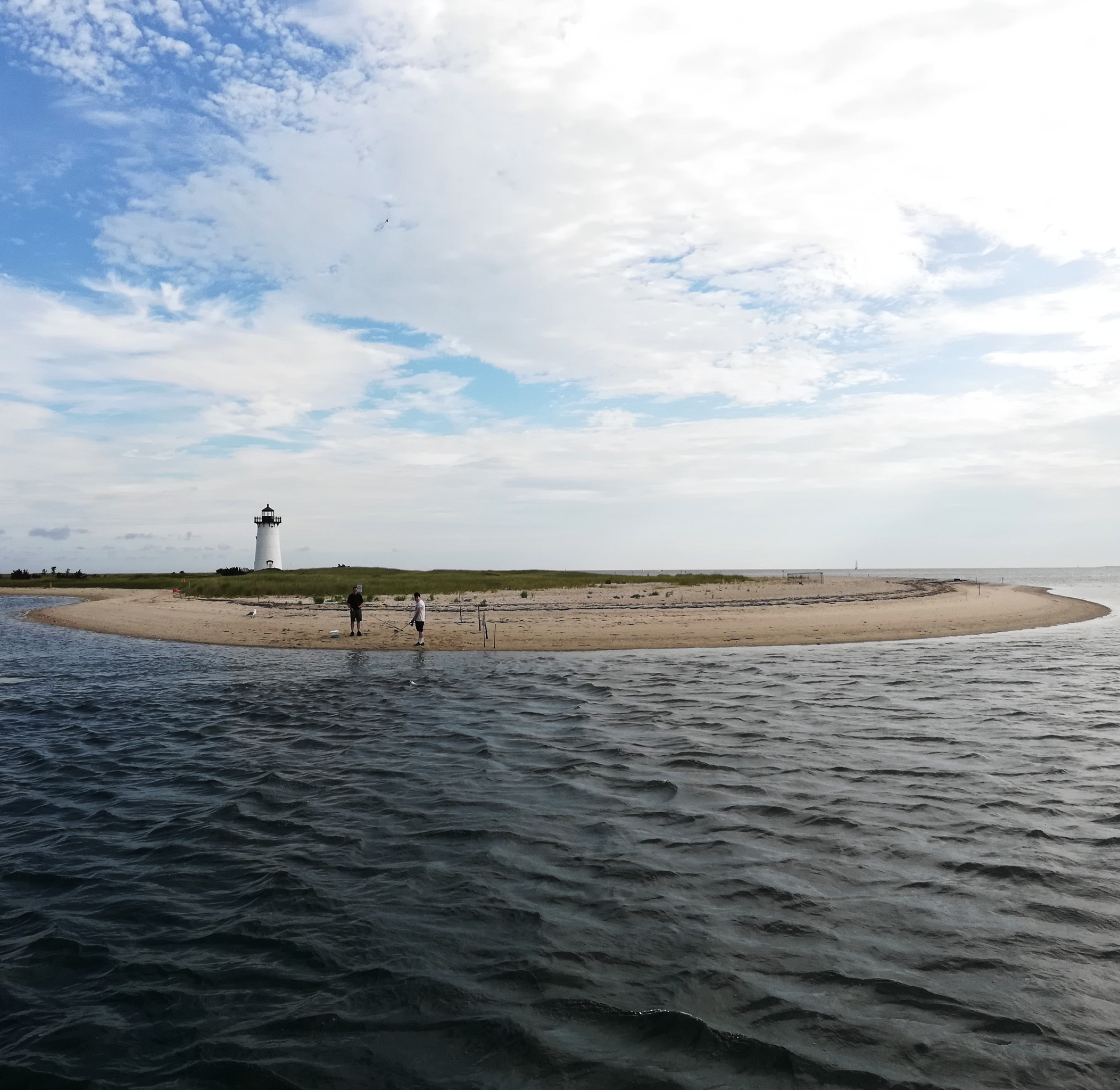
It is a very easy walk to the lighthouse from the town. We did it with my dad two years ago, and now retraced it with my crew. The lighthouse stands on a beach, aptly named “lighthouse beach”, with a narrow sandbar, partially overgrown with shrubbery, connecting it to the town.
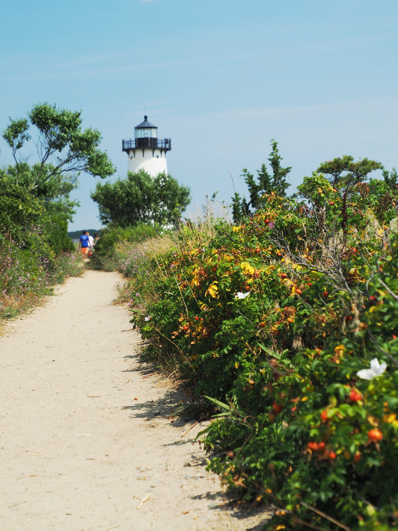
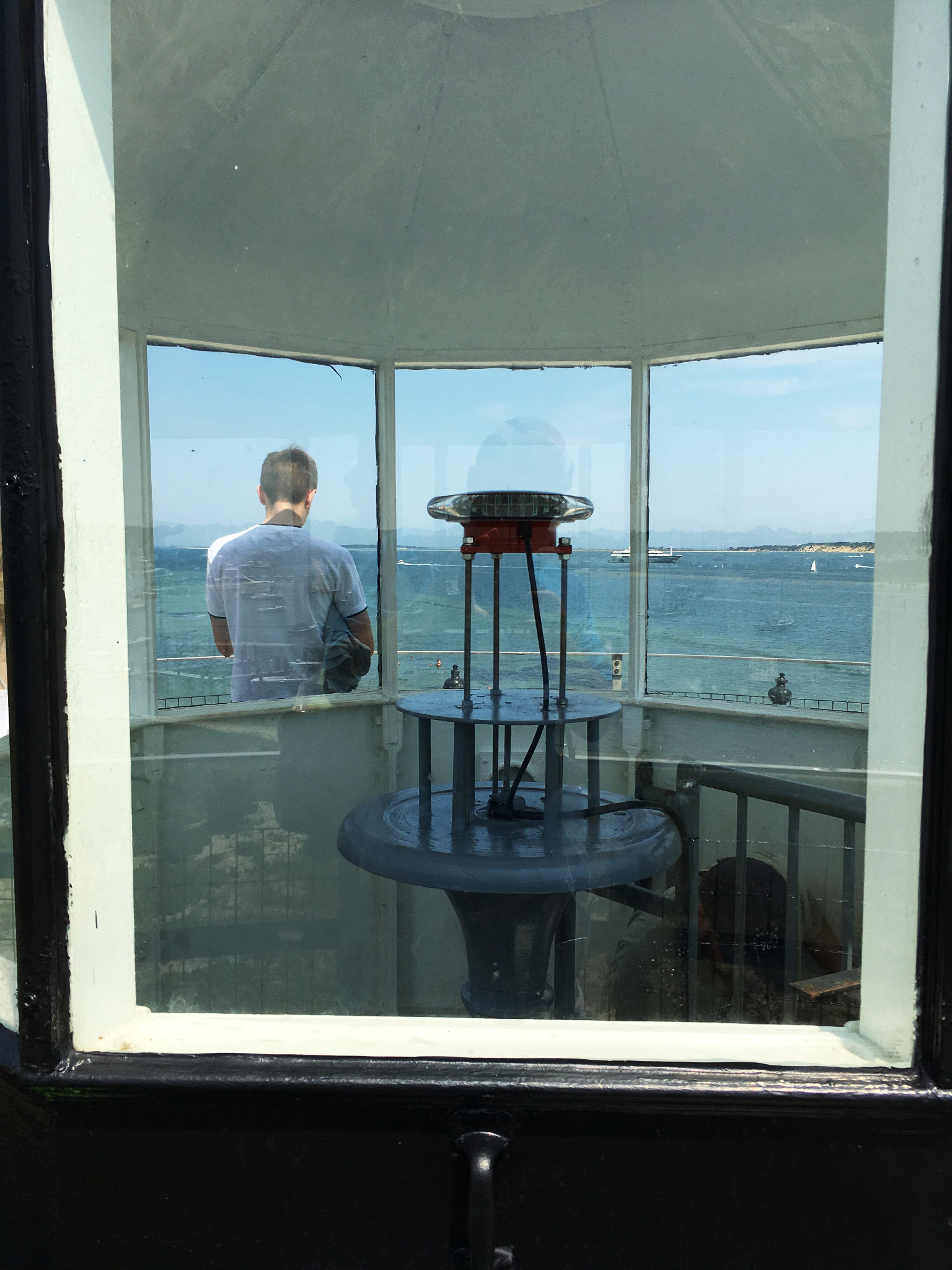
The lighthouse was closed, presumably because of the covid-related restrictions. Typically, it is open to public. Last time, my dad and I climbed the tower, inspected the lamp and enjoy the panoramic views from the top.
If you saw the old photo above of the original lighthouse, you might have noticed that there were no beach and no sandbar: the lighthouse was surrounded by water! Wikipedia has this 1908 USGS topographical map illustrating the lighthouse location:

Since then, the wind and the waves brought enough sand to create a beach and to connect it to the island. That’s Cape Cod for you, always in motion. The shores are eroding all the time (remember the Cape Pogue Light helicopter evacuation), islands keep connecting and disconnecting, new beaches showing up overnight... Even the nautical charts sometimes refuse to chart some parts of Cape Cod, saying something like “This area is subject to continual change”, or “Use only with local knowledge” — not something I’ve seen anywhere else.
Out of all lighthouses encountered during our cruise, Edgartown Harbor Light was the only one that we explored from all possible angles. First, from sea as we were approaching Edgartown Harbor from the north; then, on foot from land; and finally, as we motored into the inner harbor next morning to top off our fresh water tanks. We passed the lighthouse close by as we followed pretty narrow channel separating Lighthouse Beach from the “occasional island” of Chappaquiddick. Then, narrowly avoided the On Time (the Chappaquiddick ferry) and talked to the Edgartown harbormaster, who directed us to a somewhat unusual source of fresh water: a small wooden barge moored in the harbor, with two garden hoses and a picnic table.
Having topped off the water, it was the time for us to sail away from Martha’s Vineyard, towards Woods Hole. We passed Edgartown Light again, following the same narrow channel, and then kept looking back now and then, watching as the white tower was getting smaller and smaller behind the stern.
Lighthouses greet you first when you approach a harbor, and say their good-byes the last. As Edgartown Light and its friend Cape Poge Light, had finally disappeared, merging into the horizon, we knew that the Martha’s Vineyard chapter of our trip was over.
New adventures were ahead of us, and new lighthouses.
Subscribe via RSS