Rainsford Island
Rainsford Island was the first reachable-only-by-private-boat island that we have explored, two summers ago, and this is my report which I wrote down back then but never published before.
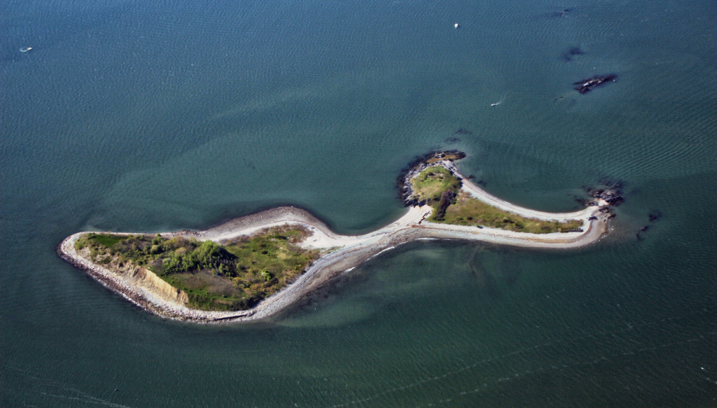
Rainsford Island lies behind Long Island, in six or seven nautical miles from our sailing club. This is how it looks from above:
As you can see, it consists of two drumlins (glacier-made hills with one side steep and the other gently sloping), connected by a low narrow neck, almost disappearing at high tide. Most of Boston Harbor islands are likewise tops of drumlins; in fact, it may be world’s only partially sunken drumlin field.
Here is our island on two nautical charts: of 1909 and of 2015. Which one is more visually pleasing to your eye?
(An important note about the modern chart: brown is land, white and blue is water, and green is the bottom which is above the water at low tide and under the water at high tide.)
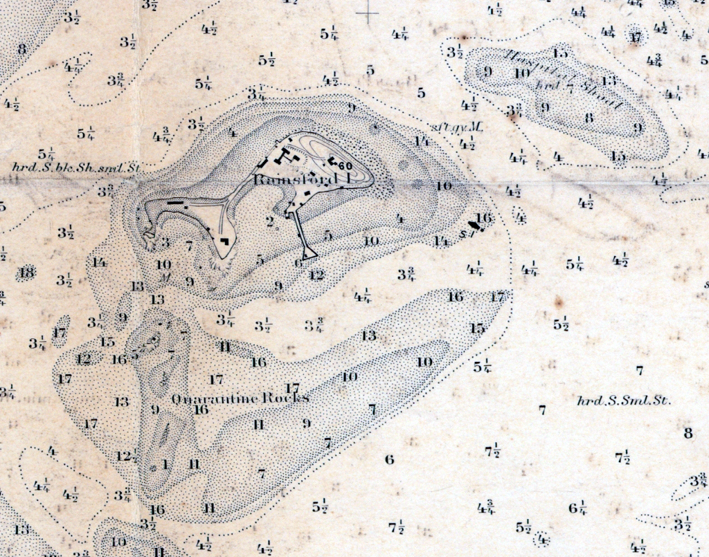
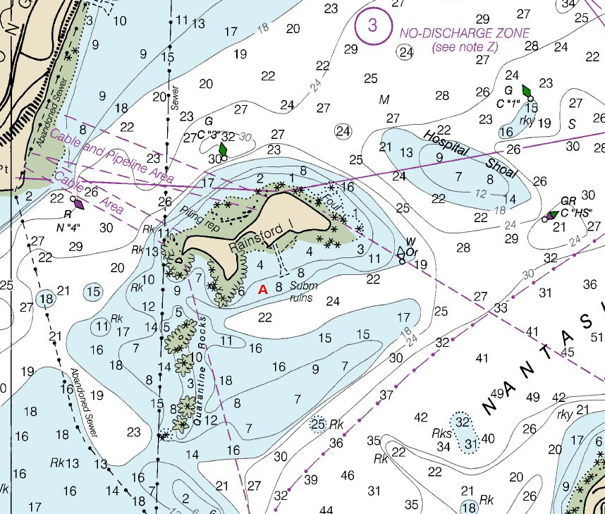
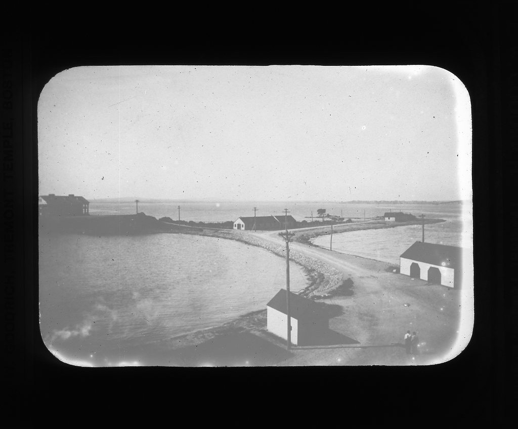
Anyhow, note the most important difference for us girls sailors: there was a dock in 1909, and it is gone today, only ruins remain.
The island is so called after Edward Rainsford, one of the first settlers, who owned the island by 1632. He is not remembered much for anything at all, unlike his more famous uncle:

The uncle, Sir Richard Rainsford (1605–1680), was the member of British Parliament and Chief Justice. He is obviously related to our island in a very indirect way. I only mention him because I like his portrait.
Today the island is deserted and neglected; it is a part of the Boston Harbor Islands park area. In the past, it had been used in many different ways. After being purchased by the state (Massachusetts Bay Colony) in 1736, it housed quarantine facilities for Boston-bound ships, a hospital, a women shelter, a correctional school for boys, an almshouse. (This explains the names of two geographic objects in the vicinity: Quarantine Rocks and Hospital Shoal.)
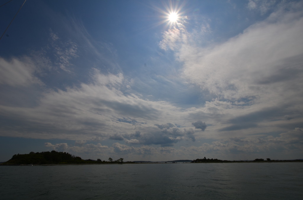
When we approached the island, this is how it looked, more or less:
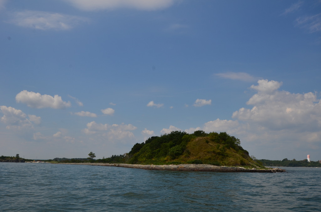
Honestly, I naively expected to find a deserted uninhabited island. Maybe with some ruins of old buildings, but not much else.
The reality turned out to be much more interesting.
But let me start from the beginning.
The first order of business was to decide where to drop the anchor.
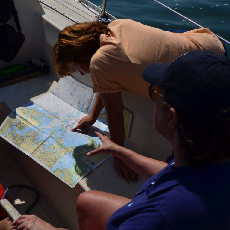
Remember, the island had no dock anymore for many years. A sailboat has a large keel under the bottom. Our boat’s draft was about six feet. If there is no dock, one has to anchor, and use a dinghy to land ashore.
There were two aggravating circumstances that day. First, it turned out that none of “my” boats in the sailing club had had a depth sounder working. And that’s the only useful electronic instrument on the boat! I am on the verge of buying a rope with a lead weight.
Second, the water was at the high tide. We have pretty large tides here, that day was about 12 feet.
It would seem that the more water one has the better, but I prefer to explore unfamiliar, unmarked waters at low tide. On one hand, the more land is uncovered, so you can see more landmarks. On another hand, if the tide is at its lowest, it means that the more water will come, and it will be getting better and better. Even running aground is not a problem: the coming tide will soon lift you.
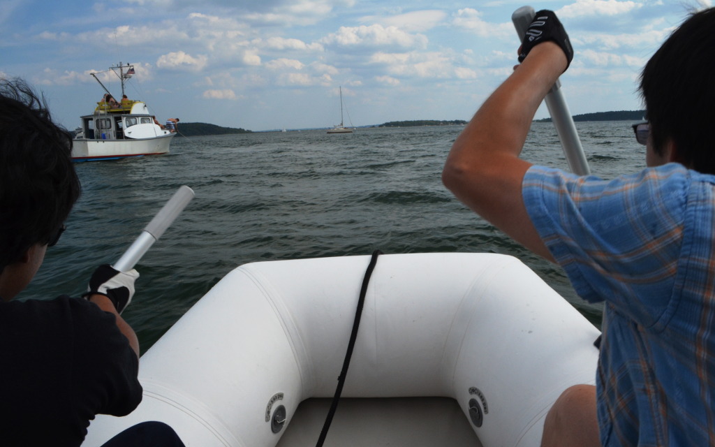
We, though, had it the other way around: high tide, the situation could only get worse with time. Well, it was what it was, it’s not like we had any choice. So we dropped the anchor behind the dock ruins, put out our small inflatable dinghy and started rowing towards the shore.
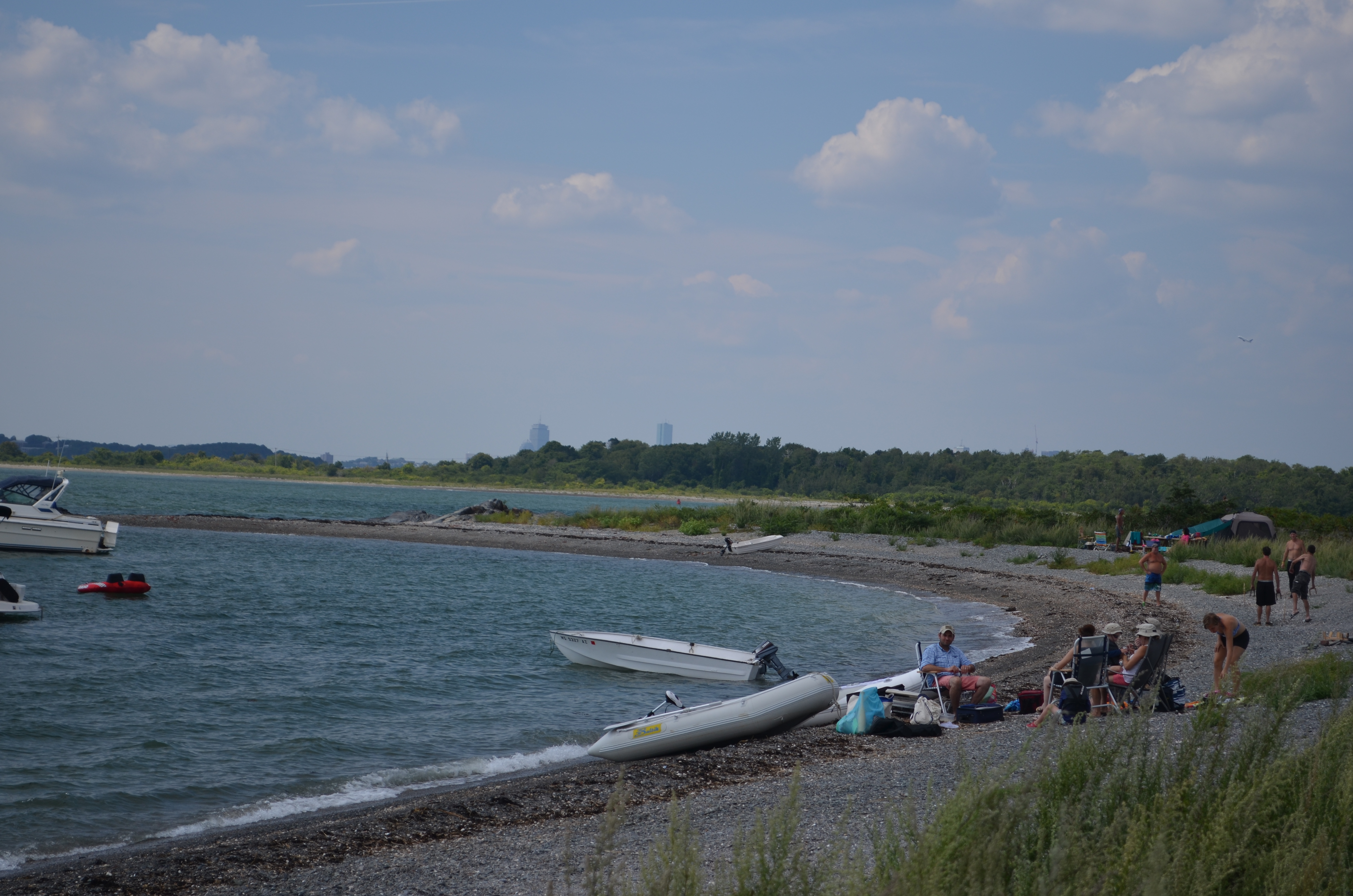
This was when we found out that the island was anything but deserted.
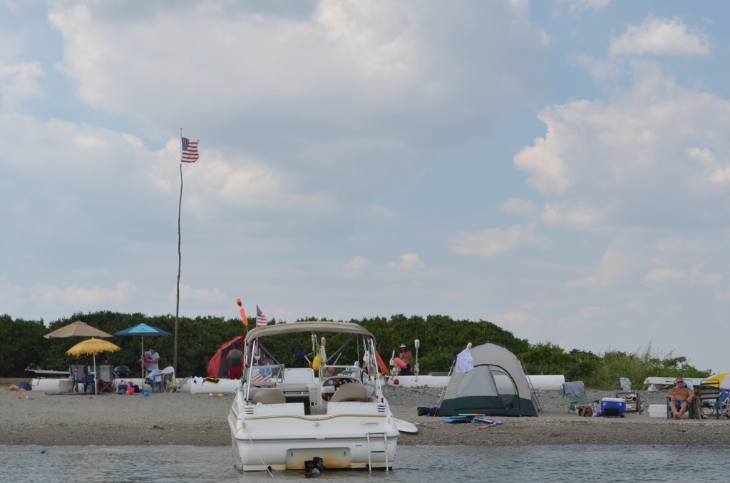
In a small cove that we were approaching, there were a lot of motor boats anchored right next to the shore. On shore there were some unidentifiable structures, tents, kids were splashing in the water, adults were cooking barbecue on fire. When we landed, I even noticed a mailbox, looking completely out of place there.
While we were looking around, a colorful man approached me, no longer young, dark with tan, and with only shorts and a hat with a feather for cloth. “First time here?” asked he.
I said, yes.
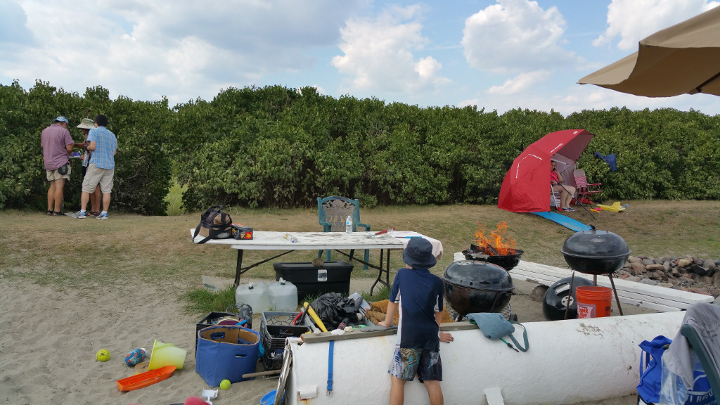
Tom told me that he takes care of the island for 57 years: picks up trash, puts up American flags, and the mailbox was also his work. “I have lost-and-found here.” In addition to that, there were old and new photos of the island in the mailbox, which he immediately showed to us.
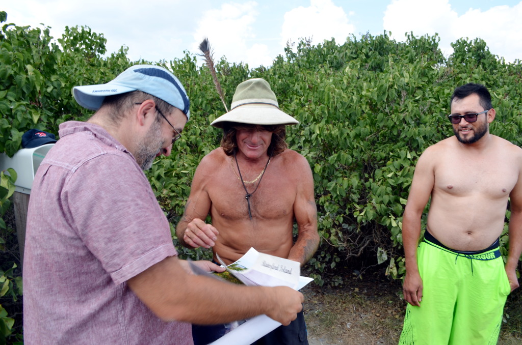
“Well, you and your…”, he hesitated, looking at my Chinese-Pakistani crew and struggling for a word… “and your friends, walk around here, look around. Remember, we keep the island in order. Do not litter here.”
With this blessing, we set out to explore the island.
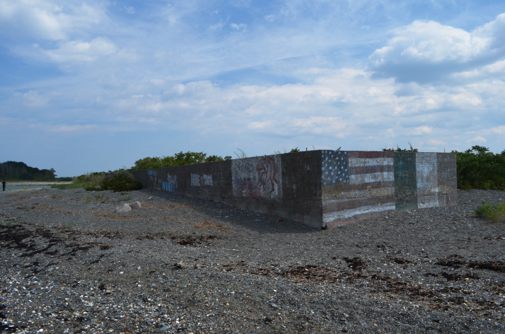
Very soon we stumbled on probably the most unexpected discovery on the island. The cove where we landed had a high rocky bluff on its left:

When we climbed it, we had found that a lot of rocks had writing chiseled on them, of the “Johnny have been here” kind. Looking closer, some of them appeared quite old—starting from mid-nineteenth century. Impossible to say for sure if the are real or fake, of course, but the font doesn’t look modern at all. And the patience which which those letters were carved in stone looks even less modern.
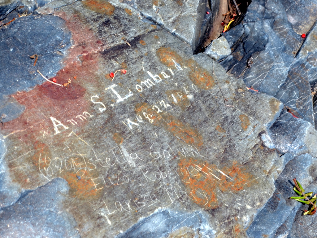
Anna S. Lombard Aug. 27, 1850
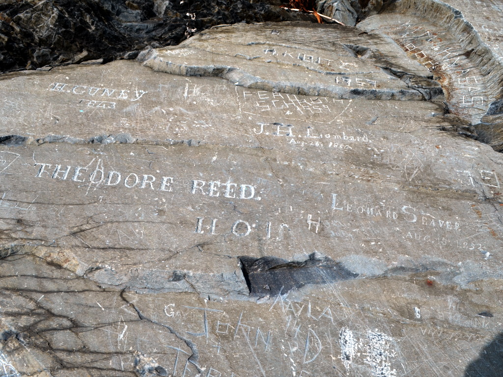
H Cuney 1843
Theodore Reed. 11.0.11 (1911, I assume)
Lombard. August 26, 1850.
Leonard Seaver Aug. 15, 1852
I have no idea who all those people were—but it would be really interesting to find out. As well as to think about how long it takes to turn vandalism into quite valuable historic evidence.
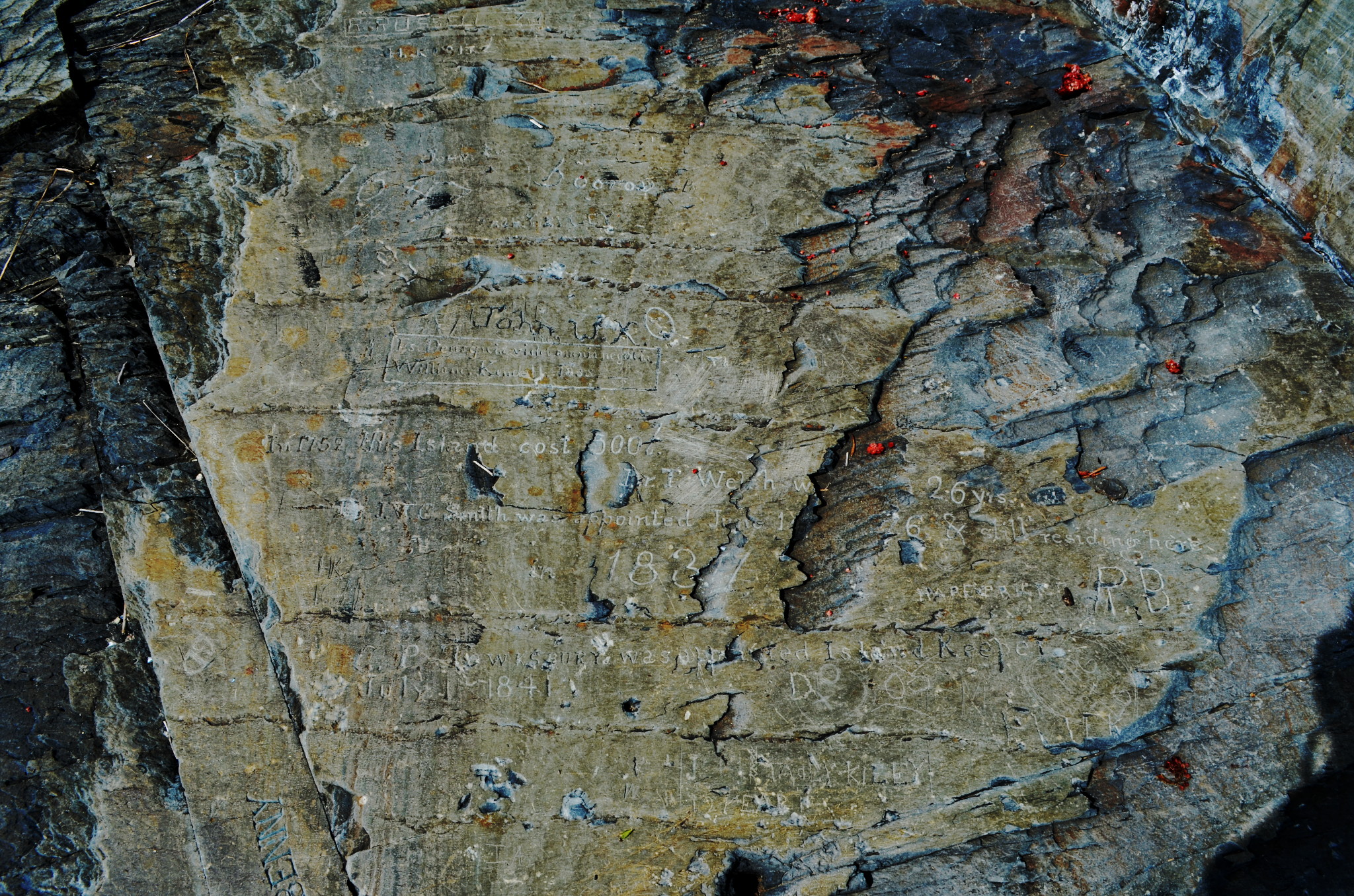
Here more is written, and it is harder to decipher. Apparently somebody had tried to write down the history of the island. Here is what I managed to understand. Some lacunas are filled in with the help of this site, where the interested reader is referred for more context.
In 1752 this island cost 500[?]
Dr T. Welsh [...] 26 yrs.
Dr J. W. C. Smith was appointed June 1[?], [18]26 года & still residing here in 1837 (Welsh and Smith, in different positions, were island’s physicians in charge.)
C. P. Tewksury was appointed Island Keeper July 1 1841
All in all, extremely interesting, and I feel we need to come back specifically to investigate these writings further.
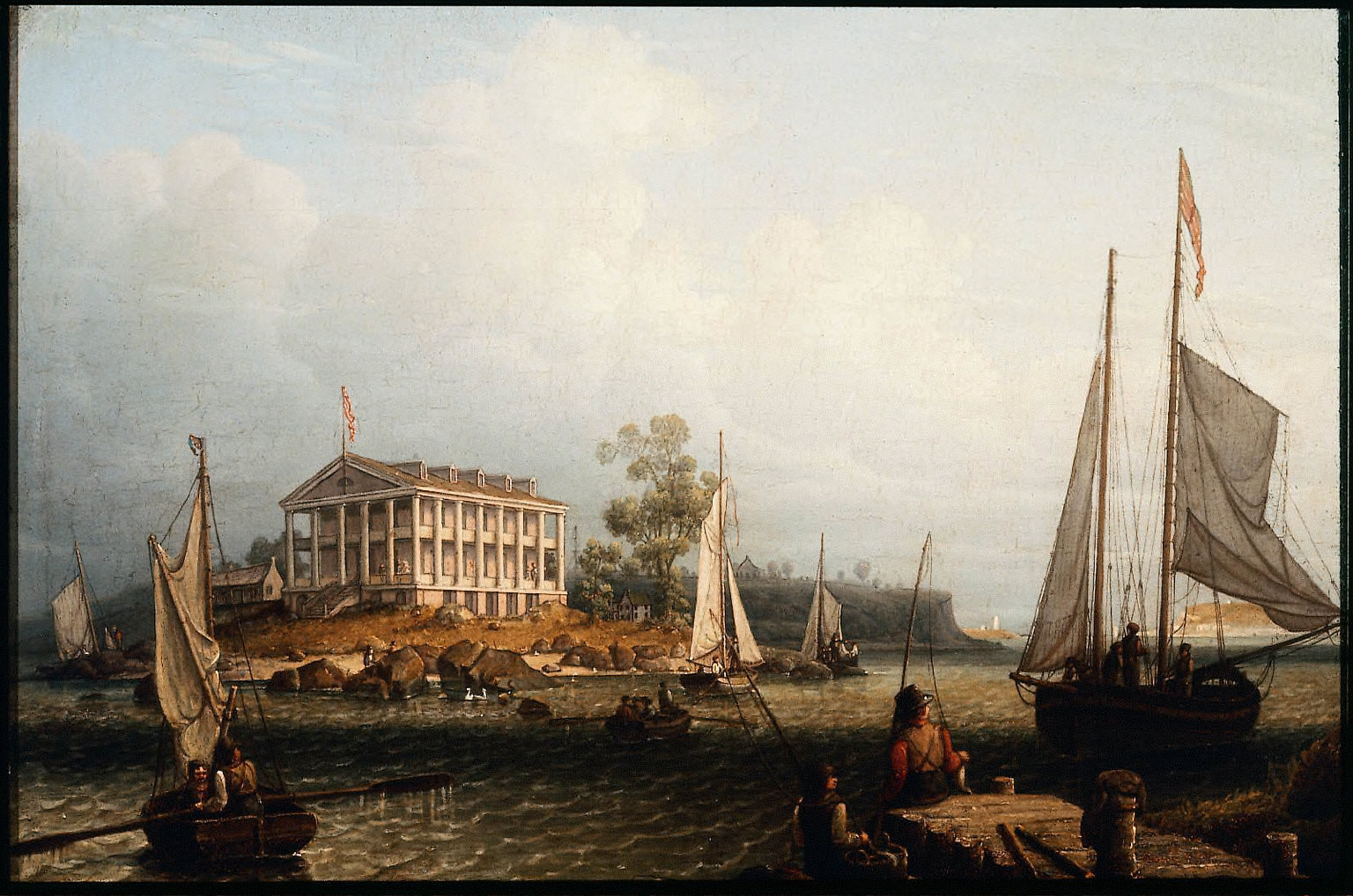
Now, moving on to another historical place. On top of the western drumlin, an imposing building was built in the 1830s. Because of its architectural style, people called it a “Greek Temple”. As far as I can understand, it used to house, at different point in time, the hospital, and the boys school, and all the other fine establishments. This is how it looked back then:
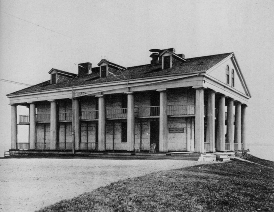
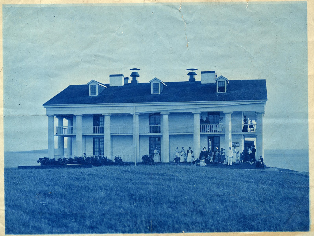
And here is how it looks now:
I already mentioned that in the late 19th–early 20th century there was a correctional school for boys on the island. The official name of the school was Rainsford Island House of Reformation, and the boys were sent there for all kind of crimes—from assault and larceny to being a “stubborn child” and “playing ball on the Lord’s day”. Put all these boys together on an island—what could possibly go wrong?!
In the school, they worked hard to reform the boys by reading books, playing games, and listening to classical music.
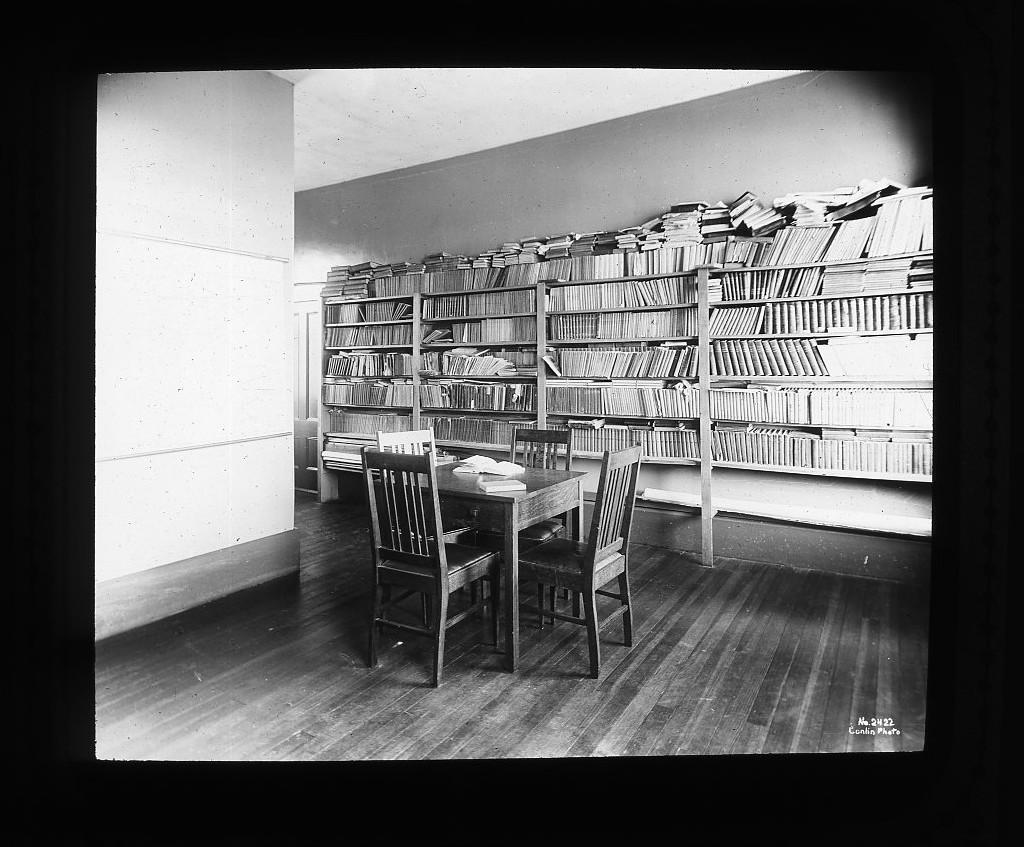
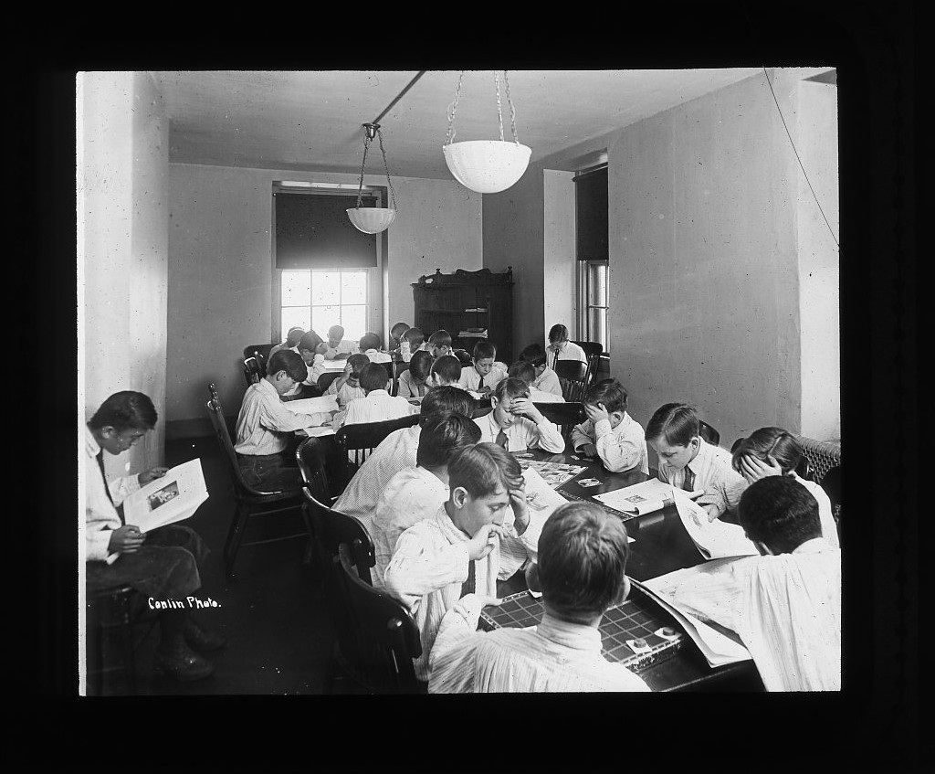
Here is how some of the school buildings looked:
The buildings are long gone now—though who knows, maybe that’s the foundation of one of them?
(The old photos from City of Boston archives were taken in 1910–1920.)
I found a very captivating story about an incident in the that reform school that happened on a foggy night of August 19, 1899. High quality, movie material.
A few days before that a boy named Joseph Sullivan had escaped the island and swam to Hull, across Boston Harbor. Before leaving he swore to his friends to come back for them if he survived the escape.
On that night August 19th the school caught fire. The school superintendent, one John Anthony, tried to get the teachers and the students to fight the fire, but with not much success: the only hose that they had was leaking in multiple places.
Meanwhile, ten boys jumped from the windows and headed towards the shore by the light of the raging fire. A few of them got into a boat that had been waiting for them and vanished into the night. The rest found a lobsterman boat tied nearby, expropriated it and also vanished.
It took some time for the firefighters and policemen to arrive from Boston. The fire was extinguished, but the top two floors had burned down completely. The policemen reported afterwards that the remaining boys were running around the island “as they pleased, like Fijis” and tried to build some rafts—anything they could—to escape their prison. One of them used a log to swim off the island, had almost drowned, was saved by a reporter (who came to the island to cover the fire) in fifteen yards from the opposite shore and then was promptly returned to the island.
The following investigation uncovered multiple violations and vcases of student abuse. Superintendent Anthony had to resign.
What a story, don’t you agree? What a rich history Rainsford Island has!
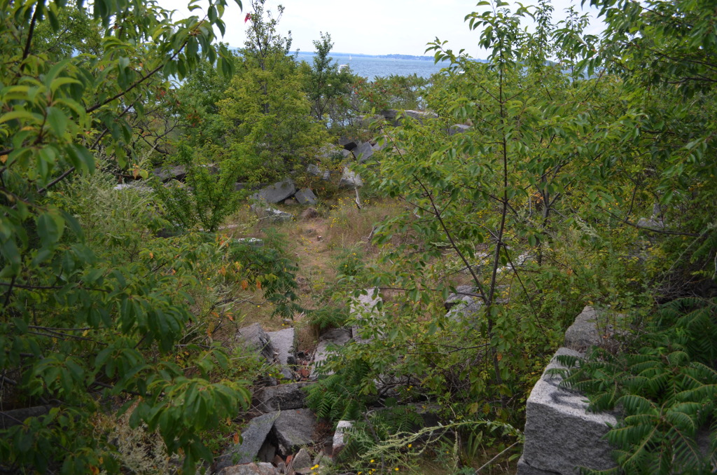
What I was impressed by the most—it is by how much is crammed into this small speck of land in the ocean.
Beach.
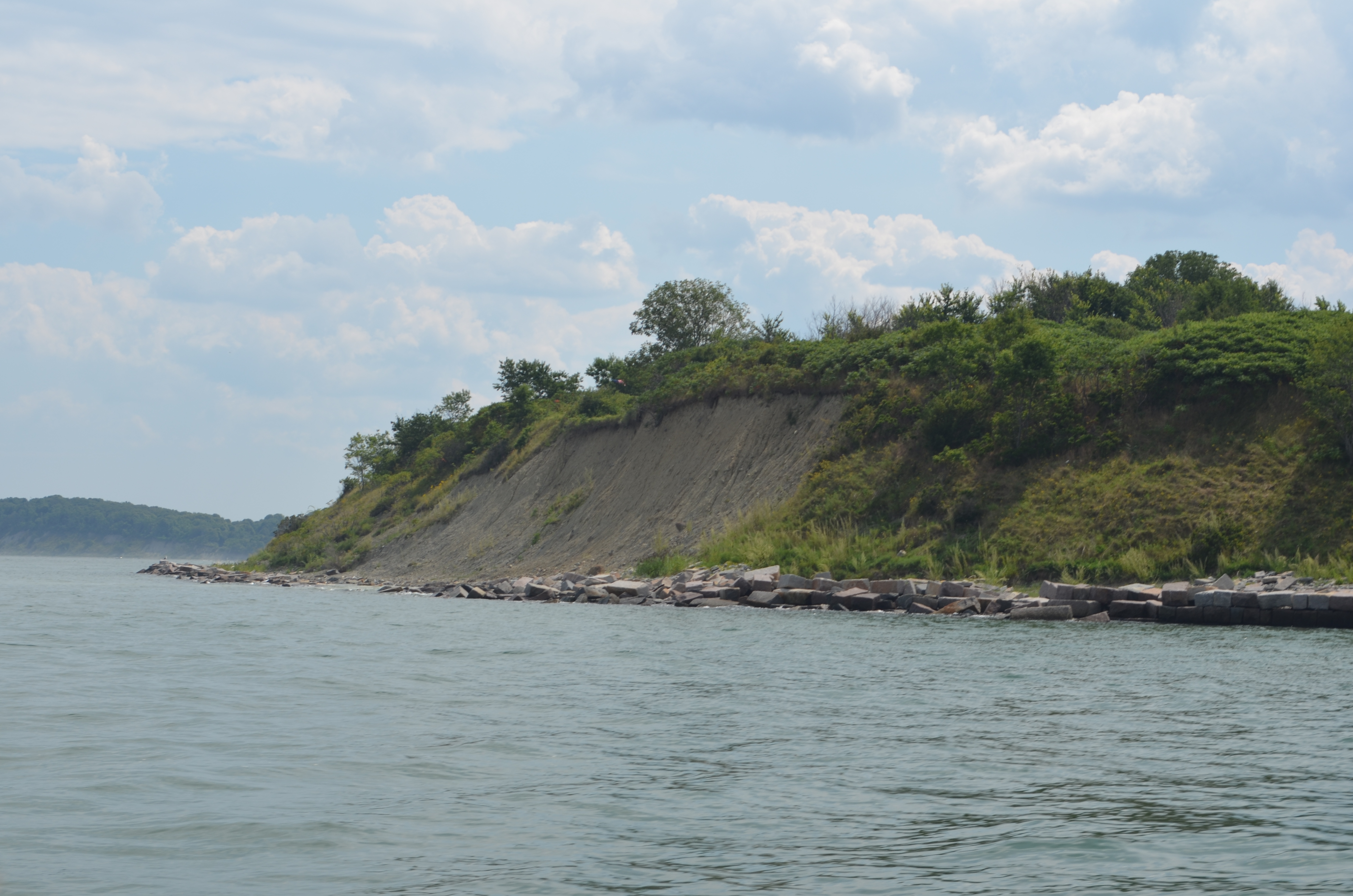
Cliffs.
History.
Ruins.
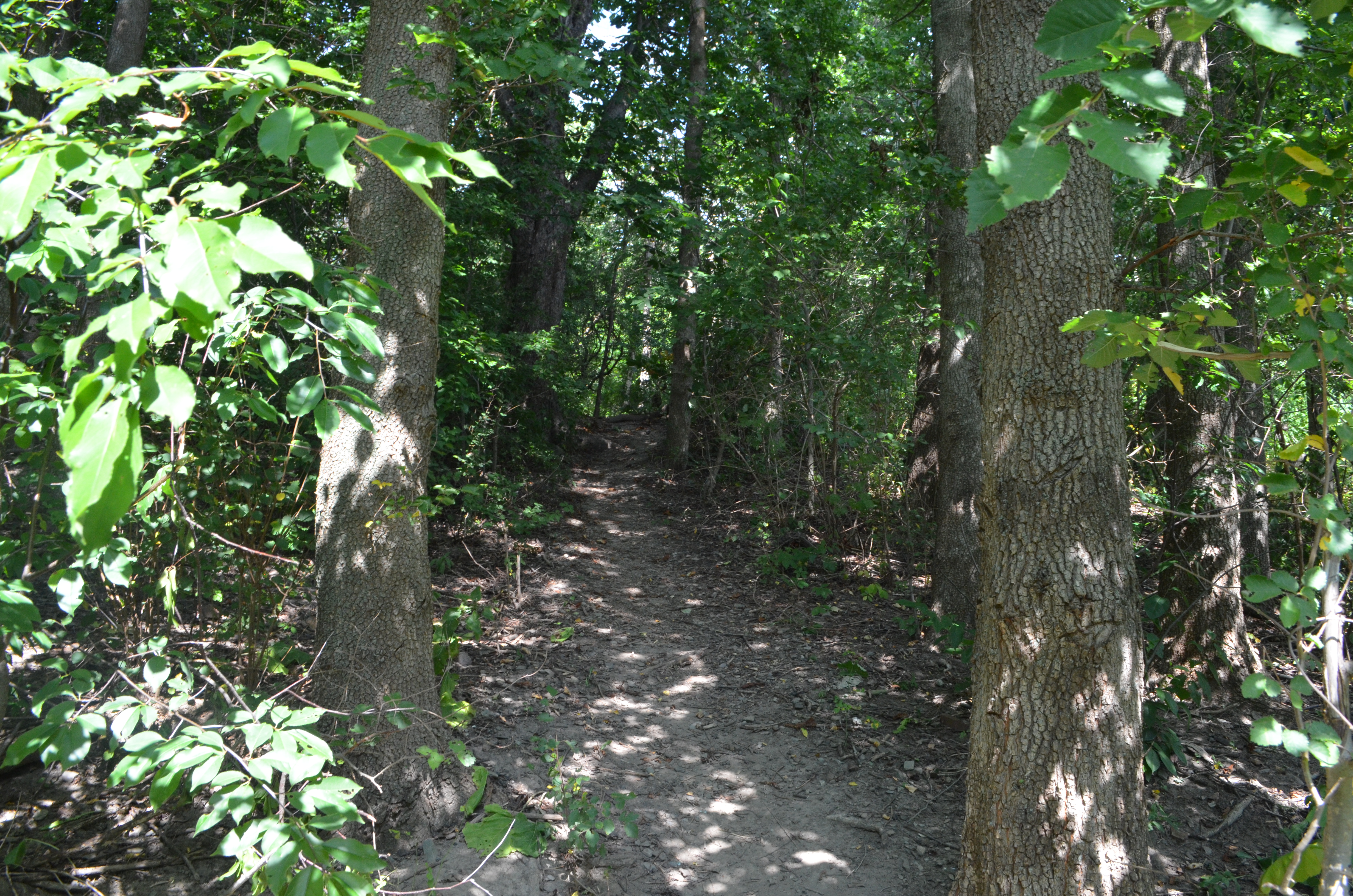
Wild forest that hides the remnants of an apple orchard.
Magnificent views.
Flat shores.
Steep shores.
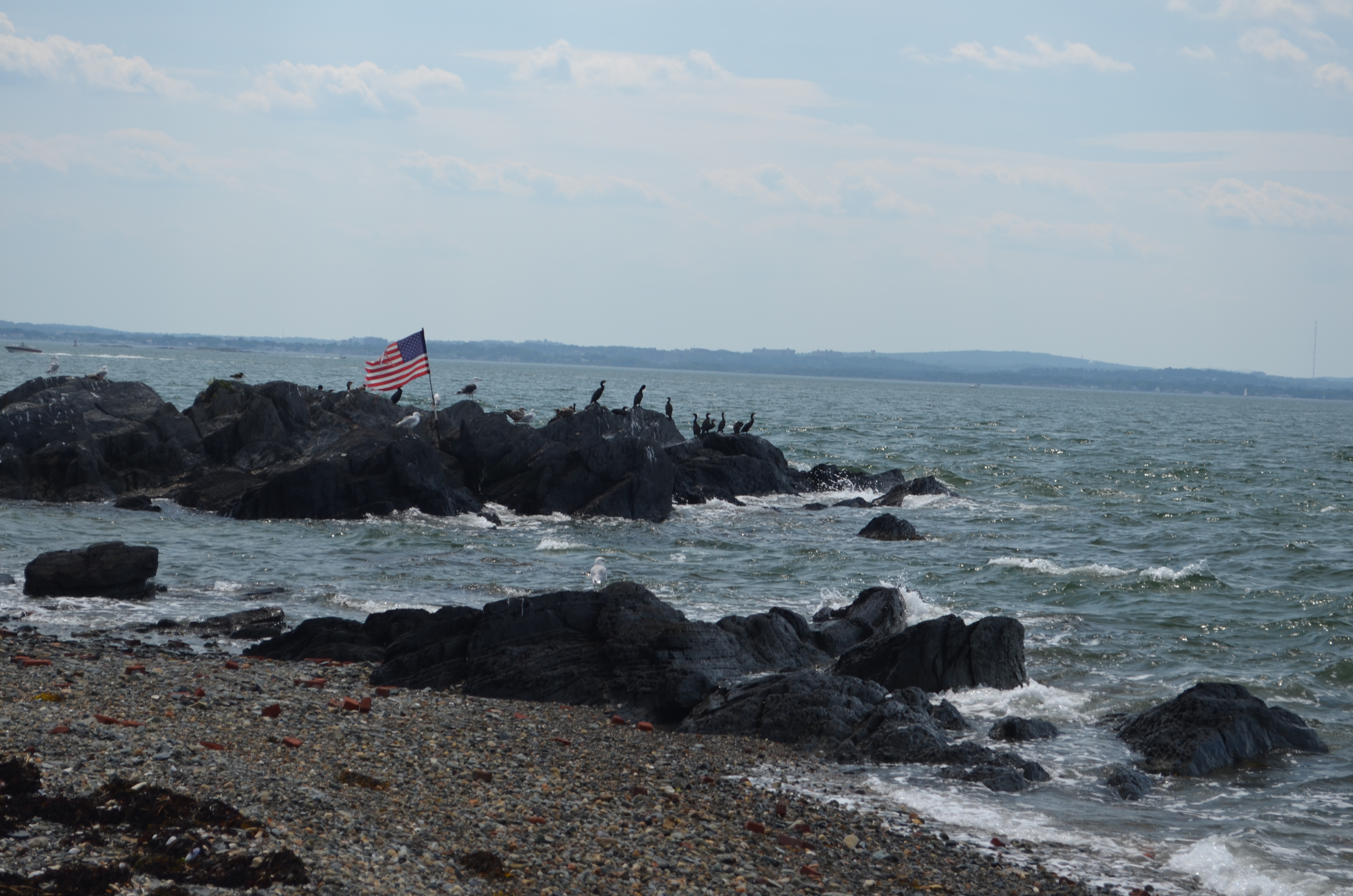
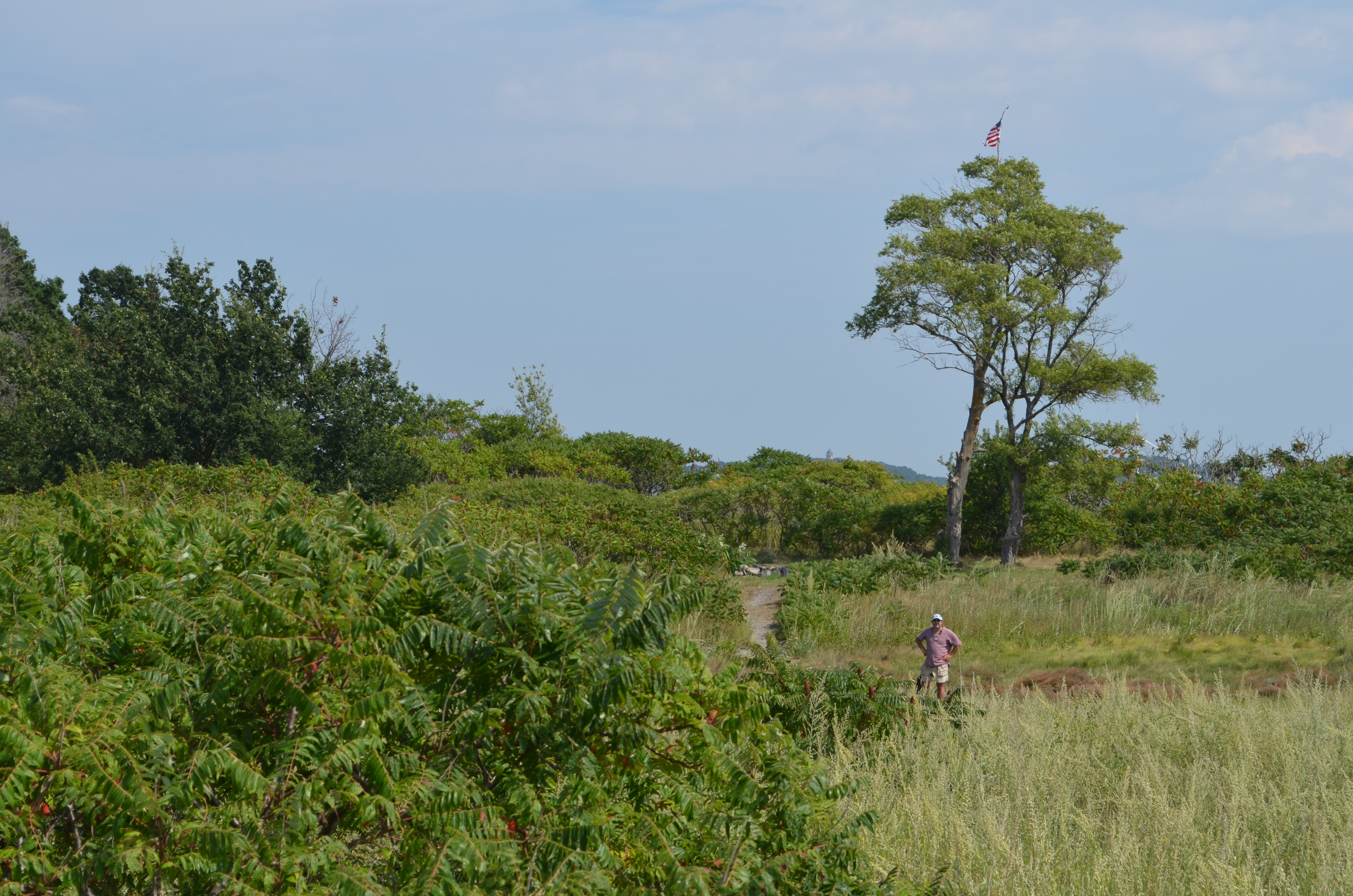
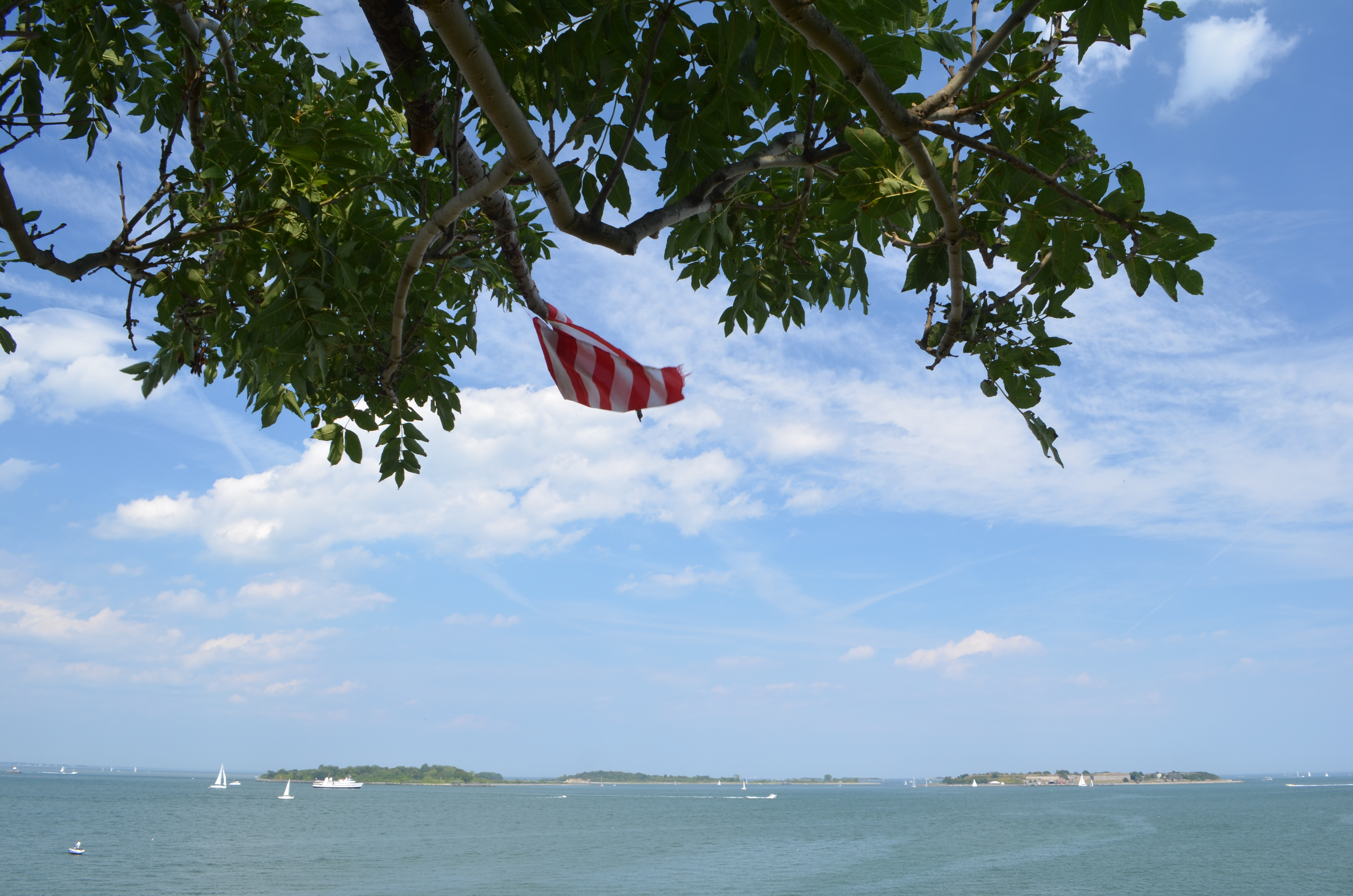
The American flags all around the place, as well as the well-prepared campfire sites, are the work of Tom and his crew.
370-degree panorama of the island (the full resolution version is here):

As my crew was rowing me back to our boat waiting at the anchor, I was thinking back to all those views. The expedition was a clear success, even more than I had expected. I promised myself to come back to Rainsford. (I actually did come back last fall, and the island was completely empty, and beautiful in a different way.)
I also promised myself to keep exploring the other islands, going down the list. That also has happened, and is happening, even though slower than I’d expected.
All those joys of exploration and discover can be yours, oh reader. Join us. It is never too late.
Finally, I found an interesting article in The Boston Globe back in 2001. It talks about the plans to turn Rainsford Island into a park. “Within five to 10 years, manicured trails, historically interpretive signs, and a new dock will introduce the public to the island.”
How lucky we are that they so utterly at all that! Otherwise, we would have had yet another manicured park. But there would be no adventure.
So here is one more important reason not to waste time, hurry up and explore the unexplored islands. Before they get manicured to death.
Photos mostly by Talha and Vyassa. Some are mine, including the title photo.
Subscribe via RSS